Get a Quote

Aerial Drone Surveys

Contact us today to find out more about our expert Drone Survey Services

Drone Survey Services

Drone surveying, also known as aerial surveying, is a cutting-edge technology that utilizes unmanned aerial vehicles (UAVs) to gather data from the air. With its ability to capture high-resolution imagery and 3D models, drone surveying has revolutionized how industries approach site inspections, mapping, and land surveying.

By providing a bird’s eye view of the terrain, drone surveying enables businesses to conduct rapid and accurate assessments of large areas of land, buildings, and infrastructure. This technology is particularly useful in industries such as construction, mining, agriculture, and energy, where high-quality data is essential for decision-making, safety, and regulatory compliance.

At AusDilaps, we specialize in drone surveying and offer a range of services to help businesses make informed decisions based on accurate data. Our experienced team uses state-of-the-art UAVs equipped with advanced sensors to capture detailed information about your site. Contact us to learn more about how drone surveying can benefit your business.

Aerial Surveys of Construction Sites

Without a doubt, UAVs (drones) have become an integral and crucial part of a worker’s toolbox. It’s no wonder that the fastest-growing commercial adapter of drone technology is the construction industry.

Drone-collected data create accurate 3D models, real-time 2D maps, and 360-degree virtual tours of any construction site. From initial site surveys/measurements, construction modelling and mapping, progress monitoring, and inspections for increasing workplace security.

Depending on your requirements and budgets, we at AusDilaps, can transform your visual inspections from a time-consuming process to a quicker, more efficient and cost-effective process.

Here’s how AusDilaps drone surveying services can help you save valuable time and costs throughout construction.

  • Keep track of on-site progress.
  • Streamline communication
  • Enable rapid decision making
  • Identify areas of concern in real-time
  • Build detailed maps and 3D models
  • Overlap old and new maps to measure progress.

You can create orthomosaics and videos for improved site planning, management, and monitoring. Producing video or 3D models of construction sites and overlaying previous inspections provides progress reports in real-time, speeding up the process of getting the funds approved from investors and financial institutions.

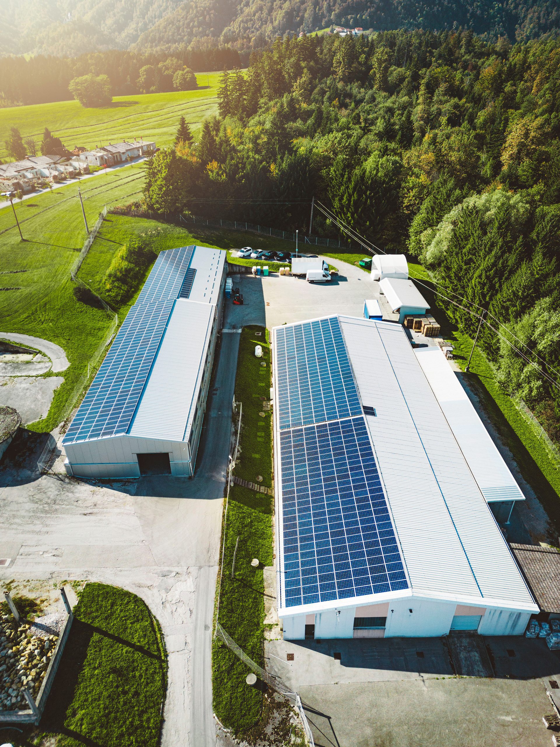
Aerial Solar Panel Inspections

The inexhaustible energy resource requires constant inspection and maintenance. Hence, timely detection and replacement of faulty panels are crucial to maintain power load and smooth operations.

At AusDilaps, using FLIR VUE camera technology on our UAV to inspect solar panels, often spanning immense solar fields. Regardless of your operation scale, AusDilaps specialises in inspecting and producing detailed reports.

We aim to provide an in-depth evaluation of solar modules and anomaly detection, which is critical to the smooth flow of the system. Expansive solar arrays can be easily, quickly, and economically inspected through thermo-diagnostic measurements by a drone-mounted camera.

AusDilaps uses the FLIR VUE infrared system for a complete visible spectrum of a panel. The camera uses thermal imaging and temperature readings that can rapidly inspect a large area of any power plant. The imagery produced by the thermal camera can detect heat leakage and provide an accurate thermal reading from any panel or circuitry to enable the client to identify and quickly remedy the issue, saving time and money.

Once updated, the records and images are analysed through AusDilaps (in-house) software packages, and reports can be produced by our team of engineers to offer the best maintenance and repair solutions for the operation.
Ask AusDilaps TODAY about protecting yourself during your commercial construction or development project

Call Our Team
1800 345 277

Request a Quote

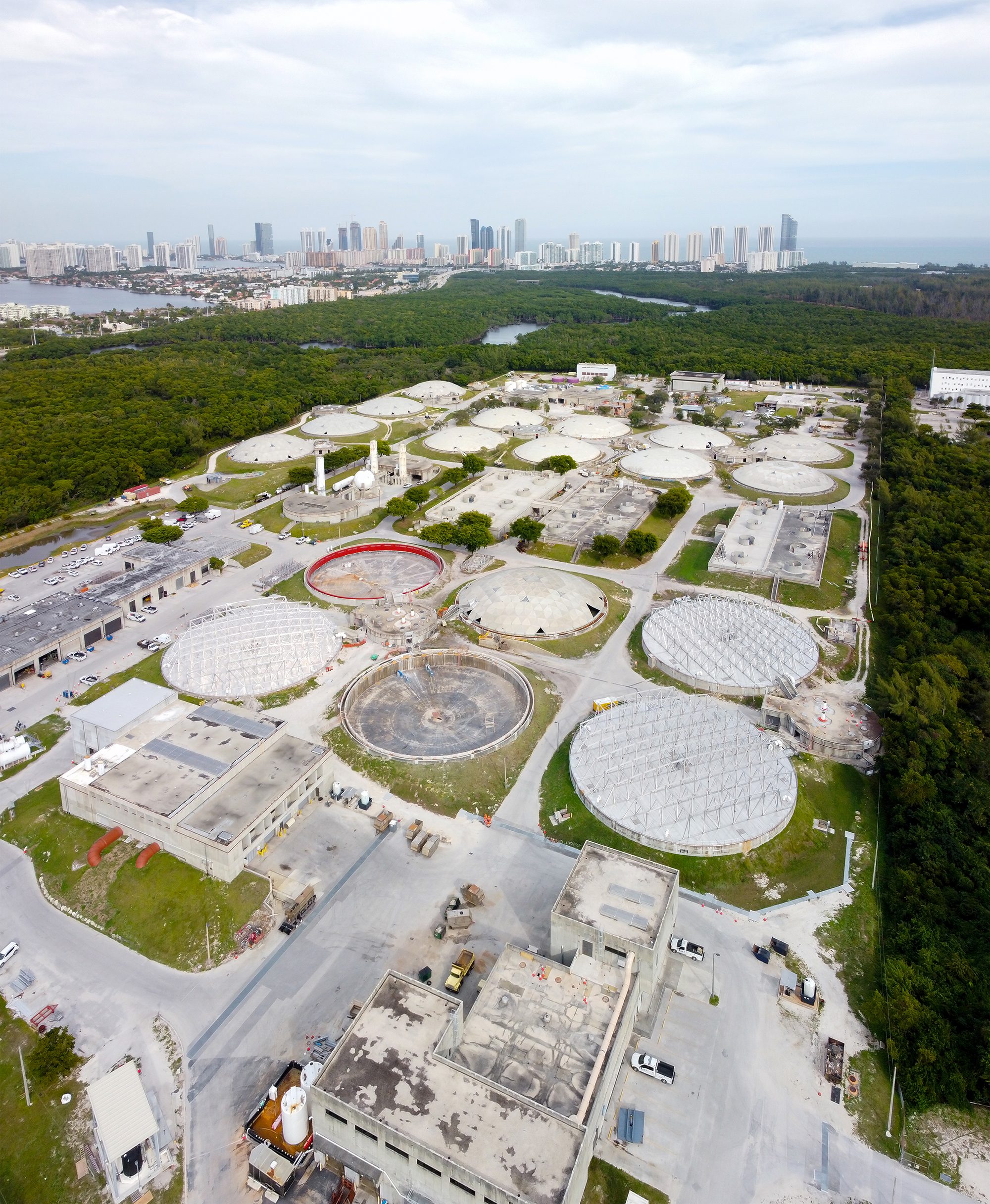
Aerial Inspections of Mine Sites, Landfills and Quarries

At AusDilaps, our goal for the mining industry is clear- to increase the profitability of your business. Due to the complex nature and dangerous worksites of quarries and similar sites, drones provide a quick, safe, and efficient alternative to manual inspections.

Not only are manual inspections extremely time-consuming, but they are also highly susceptible to unexpected safety hazards. 3D data collected through drones offers a precise volumetric calculation of stockpiles and the quantity surveying of any material. This is precisely why the mining industry has become one of the fastest adapters to drone technology.

Data collected through drones is more cost-effective, comprehensive, and accurate, all without exposing valuable manpower to hazardous and toxic environments.

AusDilaps keeps you updated with volumetric calculations at every mining process step. As a result, miners or landfill managers can inspect their terrain and monitor stock levels and assets at every stage of the cycle.

Our aerial systems can cover an expansive area and measure piles of quarry materials or landfills. The in-depth topographical survey helps in stockpile measurements, contour planning and land inspection.

Work is streamlined, quick, and hassle-free with real-life visual imagery accurate to 10-20mm.

Aerial Inspections of Roofs and Infrastructure

Drone technology has revolutionised building and infrastructure inspections. No matter how high or how vast, AusDilaps is there to help you with a comprehensive inspection and provide you with precision data and imagery that you can rely on to make informed decisions about your infrastructure.

Using 3D orthomosaic modelling clients can look at their infrastructure from any angle.

Our aerial systems are capable of close visual inspections of building roofs and facades to assist in the fast detection of defects such as damaged tiles, brickwork, facade cracks and window lintel issues. Thermal cameras can also be used to detect leaks in buildings or houses. Geo-referenced images allow for easy reference to the defect area. 3D modelling can also be created to provide incredibly detailed context to the asset and its condition.

We offer our clients cost-effective and high quality data and imagery for analysis that reduces the risk of working at heights.

AusDilaps drone surveying services offer tremendous cost savings compared to standard manual methods of surveys on all types of residential, commercial, industrial, and historic buildings. We can achieve high precision accuracy as well as reduced costs due to less time needed on-site – surveys completed in a few hours. Moreover, there is no need to hire access equipment or scaffolding.

Roofs completely inaccessible by traditional methods, fragile roofs, or those containing ageing asbestos materials are best left to us at AusDilaps drone inspection service.

Environmental Surveys by Drone

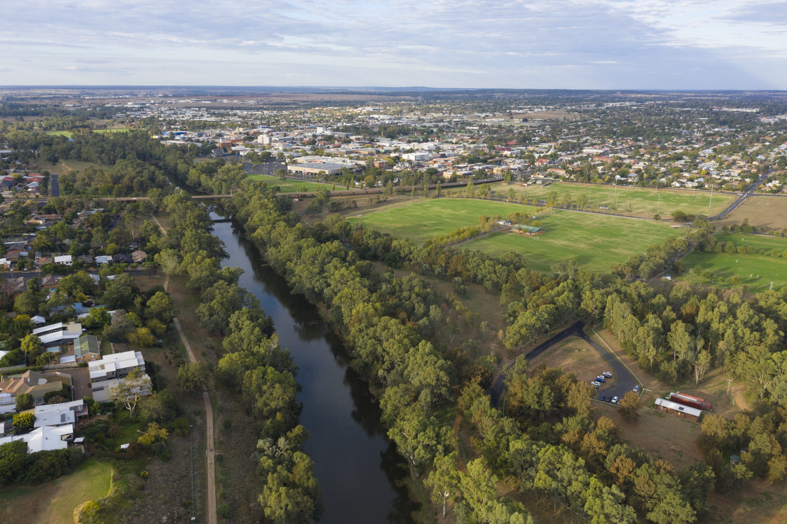
AusDilaps operates the most sophisticated and advanced technology to provide detailed photographic data on waterways and dams. Our professional-grade, latest-technology UAV, operated by fully certified and experienced pilots ensure you receive the most comprehensive, precise and informative data needed for environmental mapping.

We provide the best solutions tailored to our client’s requirements to ensure the best results. Our environmental mapping surveys are customised to suit any requirements.

UAVs offer safer and more cost-efficient mapping or monitoring of large areas. Our range of monitoring and mapping services includes measuring changes in water levels or erosion over time using point cloud orthomosaic mapping and generating millimetre-accurate topographic measurements of the surrounding terrain.

AusDilaps can provide detailed reports for environmentally sensitive areas amidst thick scrub, gorges, wetlands, and ridges using Multispectral cameras. Our detailed reports provide accurate data that can be obtained without disturbing sensitive areas.
Aerial Drone Mapping and Photogrammetry

Asset owners, builders, tenants, and building managers are now looking for a safer, quicker, and more affordable substitute to provide an accurate and detailed survey of the condition of commercial assets, buildings or worksites of any kind.

AusDilaps provides inspection services for all Real estate, Agriculture, Construction, Insurance Companies, Security Agencies, General Inspections and Everyday Personal Events.

AusDilaps delivers a safer, highly efficient, and less-expensive approach to manual survey techniques.

Before beginning construction on an expansive site, it is crucial to take note of all available equipment, site hazards, and stockpiles. While it’s true that a standard map can provide this data, AusDilaps systems take the game one step ahead.

Before beginning construction on an expansive site, it is crucial to take note of all available equipment, site hazards, and stockpiles. While it’s true that a standard map can provide this data, AusDilaps systems take the game one step ahead.

Using the latest drone systems technology and expert survey personnel, we can build and deliver specific data sets to you when you need them the most. Using precision RTK and PPK positioning systems, we can generate 3D point cloud mapping with precise GPS positioning; with this data, we can produce 3D modelling of buildings, towers, and various assets.

Providing accurate data allows the client to manage side-by-side comparisons pre-, during, and post-construction comparisons. By overlaying and viewing the imagery simultaneously, the client can gauge the progress and pace of construction.

Call us now for an estimate on your project!

AusDilaps has a wealth of experience in providing structural engineering services at an affordable rate. If you would like to know more about how we can help with your project, please call us today!

Ask a Question
Request a quote
Commercial Dilapidation Reports

Owning a commercial property is a significant investment. If you are planning a project…

LEARN MORE

Commercial Dilapidation Reports
Industrial Dilapidation Reports

An industrial building can play an important role in your business. For high-quality industrial d…

LEARN MORE

Industrial Dilapidation Reports

An industrial building can play an important role in your business. For high-quality industrial d…

LEARN MORE

Residential Dilapidation Reports
Structural Dilapidation Reports

Whatever you’re building, if you’re worried about the effect on surrounding structures…

LEARN MORE

Structural Dilapidation Reports
Dilapidation Reports – Your best step to construction risk management.

Contact us now, before its too late!

Request a Quote
Phone: 1800 345 277
Privacy Settings
We use cookies to enhance your experience while using our website. If you are using our Services via a browser you can restrict, block or remove cookies through your web browser settings. We also use content and scripts from third parties that may use tracking technologies. You can selectively provide your consent below to allow such third party embeds. For complete information about the cookies we use, data we collect and how we process them, please check our Privacy Policy
Youtube
Consent to display content from - Youtube
Vimeo
Consent to display content from - Vimeo
Google Maps
Consent to display content from - Google
Spotify
Consent to display content from - Spotify
Sound Cloud
Consent to display content from - Sound
Get a Quote