Contact us today to find out more about our expert commercial dilapidation services
LiDAR (Light Detection and Ranging) offers a non-intrusive, high-speed method for capturing the shape, surface, and scale of built and natural environments. While not a replacement for close-range defect inspection, LiDAR delivers powerful context—especially on large, complex sites.
AusDilaps offers LiDAR scanning as a complementary service for clients who want comprehensive visual and spatial data to support planning, documentation, or digital twin development.
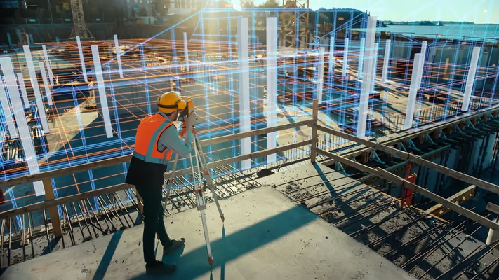
LiDAR is ideal for:
Mapping large infrastructure assets with difficult access
Creating accurate site-wide 3D terrain models
Supporting preliminary condition capture before more detailed assessments
Building digital twins for long-term asset monitoring
Providing visual overlays for stakeholder presentations or compliance documentation
LiDAR won’t solve every problem—but for the right site, it’s a powerful addition. If you’re unsure whether it’s a fit for your needs, we’re happy to advise.

Protect yourself with the number one choice in Australia for Dilapidation and Engineering Reports
+1800-345-277
info@ausdilaps.com.au
6 Plover Court
Albany Creek, QLD, 4035
Australia
Copyright © 2025 AusDilaps. An Urban Pulse Strategies Company | Powered by MPS